City model data

Espoo’s comprehensive 3D city information model adheres to the OGC CityGML 2.0 city model standard.
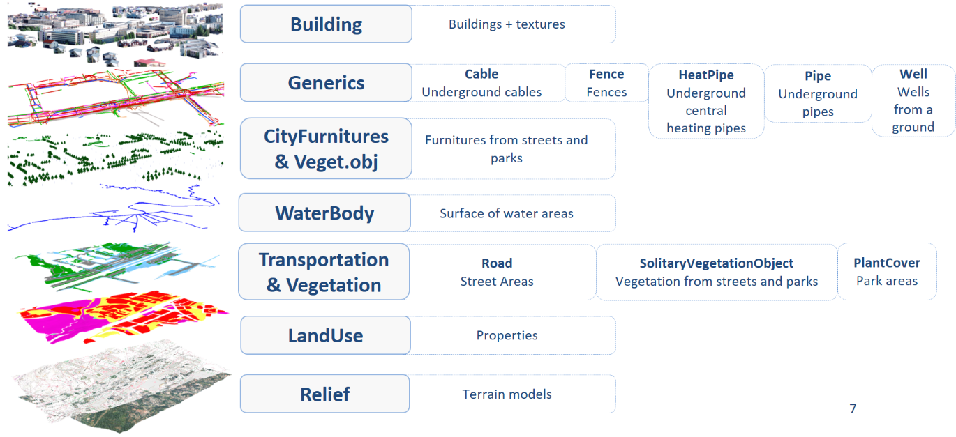
Object types

Espoo’s city information model covers all object types contained and defined in the CityGML standard with the exception of engineering structures (bridges and tunnels).

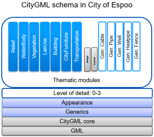
In addition to the basic objects of the standard (represented in blue), the standard allows Espoo’s city information model to include generic objects. Espoo mainly uses generic objects to visualise underground infrastructure (represented in white, Gen:*).
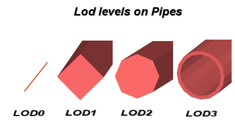
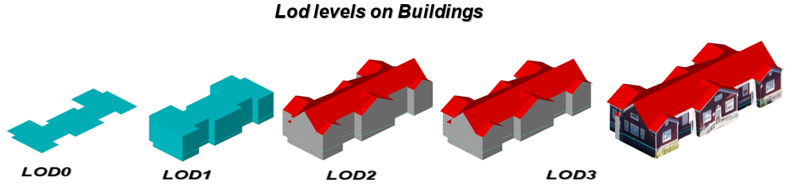
3D kaupunkimallin kohdetyypit
Data examples and object types

Levels of detail

The object types of the city information model can be rendered at different levels of detail (LoD) ranging from 0 to 3.

3D kaupunkimallin tarkkuustasot
A building rendered at different levels of detail.

Textures

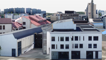
Buildings can be supplemented with wall and roof-specific textures (Appearance) as https links.


Detailed information about the data

The table below describes Espoo’s city model in closer detail.

Publication of object types at different levels of detail and their descriptions

Featuretype LOD 0 LOD 1 LOD 2 LOD 3 Type Description
Buildings 3D objects completed buildings
LandUse area properties
PlantCover area parks (property of infrastructure)
Road area streets (property of infrastructure)
Relief area laser scanning 2021 (grid)
WaterBody area water areas from base map
CityFurniture point furnitures (property of infrastructure)
SolitaryVegetationObject point vegetation (property of infrastructure)
Generics
Cable line-pipe undeground cables
Pipe line-pipe undeground pipes (water-waist)
Heatpipe line-pipe undeground pipes (heat)
Well point wells connected to undeground pipes*
Fence line fences from base map

Available on open data

Open data covers geothermal wells only

Not available on open data

Buildings

An example of a building rendered at different levels of detail (LoD0–LoD3):

Building walls include wall-specific texture links (https links) to better visualise the object.

The terrain intersection line of a building (TerrainIntersection) is rendered according to the selected level of detail.

The interface will render a building at the requested level of detail. If the requested level is not available, the building will be rendered at the highest level available.***

Due to the technical solution used for building modelling, some buildings available at LoD3 are not available at LoD2, and a solid is missing from some buildings at LoD3.**

**As 3D modelling of buildings is still underway, not all buildings can be rendered at LoD2 and LoD3.

Relief

The relief model is based on a topographic model generated in 2021 with laser scanning. The grids used in Espoo’s city model are also derived from the topographic model, enabling the creation of efficient and well-functioning city model.

To ensure efficient usability, the interface service renders the relief as a grid. The sizes of the grid’s sections depend on the level of detail..

LOD 0 LOD 1 LOD 2 LOD 3
Relief model grid size (m) Plane 10*10 100*100 25*25 10*10

The high levels of detail are also available, if necessary. However, this may not be a suitable solution for rendering extensive areas due to the high quantity of data. Further information: Data request service

Areal objects

The relief model of a land use object area is “cut” from the relief model at the desired level of detail.

LoD0 serves as a surface whose height is determined by the height of the area’s lowest point, using a relief model determined by the selected level of detail.

Pipes and wells

The intersections below illustrate how the number of edges used to render pipes and wells vary at different levels of detail.

Object attributes

The objects of the city model also have a significant number of attributes not covered by the CityGML schema, represented as generic attributes. These generic attributes make it possible to represent objects much more specifically than the CityGML schema would otherwise allow.

Generic attributes significantly increase the potential uses of the data. If necessary, new generic attributes can be added, or the existing ones can be tailored to meet specific needs. Further information: Special materials


Maintenance

The city information model is maintained through efficient and controlled processes in the city’s technical services. This enables the management of information produced and needed by decision-makers, planners and builders as part of the city information model.

Geometric and visual maintenance is connected to the traditional base map and infrastructure property maintenance. The latter two serve as sources of traditional spatial data and map data, and also data for the city information model.


Espoo’s 3D city model is maintained in Trimble Locus.